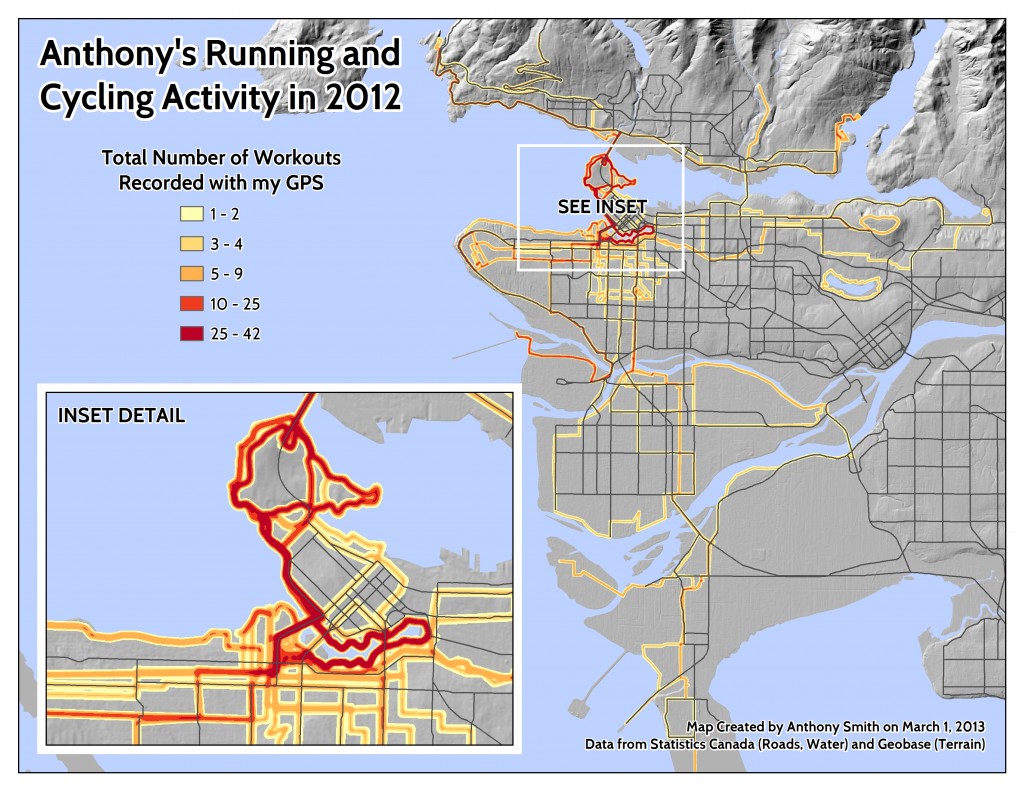
My second new map was over one year in the making, that is because I have been collecting about 80% of my running and cycling activities using a Garmin Forerunner 405. I usually do this to track my total workout distance, pace, elevation gain, and interval times, but this was a nice way to get some value added out of the data. First of all, I downloaded the 77 workouts from the Garmin Connect website as individual .KML files. I then used Google Earth to bundle these all into a single .KMZ. This trick saved me a lot of work over importing each .GPX file directly from my watch and converting them one by one to shapefiles. After importing the .KMZ file to ArcMap, I simply converted the KMZ. to a new projected the line file in a geodatabase. Finally, I proceeded to run a kernel density function with a 100m bandwidth as shown below:

As you can see I tend to run around the False Creek and Stanley Park seawalls while my cycling adventures are more diverse. I may be the first to have done this type of route mapping in Vancouver; however, there is also a great example using Nike+ data in New York City that I discovered after designing my map. I would love to get access to a large data-set like MapMyRun.com and create a running density map for the whole city. Please let me know if you have done any thing like this or have seen other great examples online?