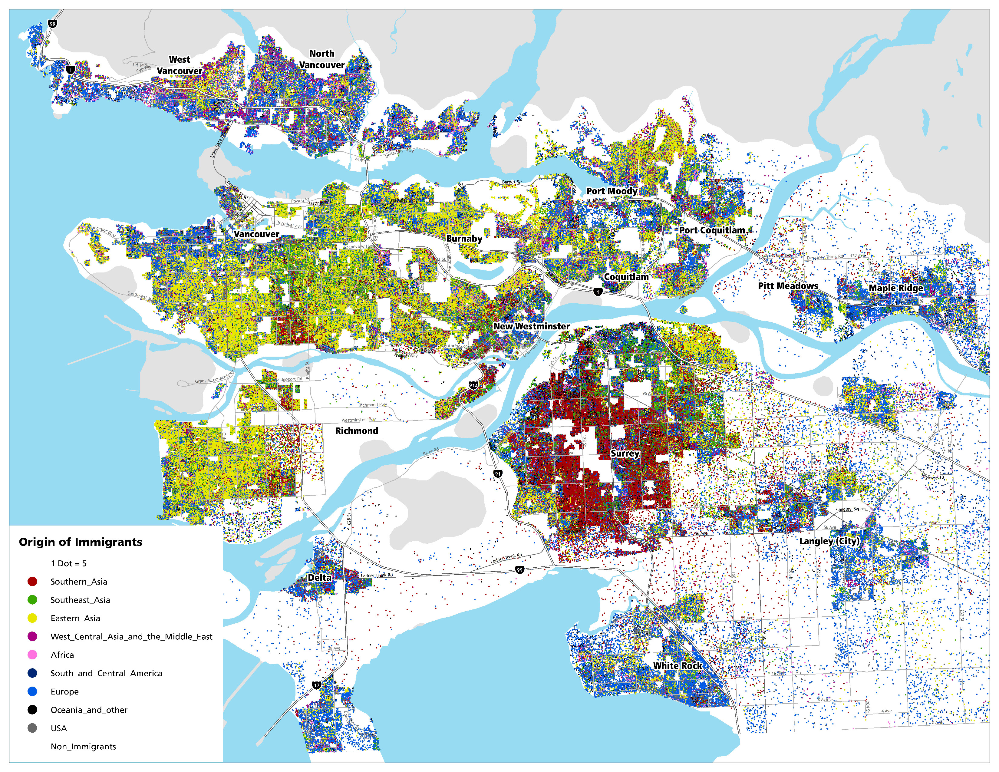
Do you wonder where immigrants who have settled in this area moved from? Or perhaps you are curious why and where many people from the same origin region tend to cluster together into distinct geographic areas that are often called ethnic enclaves. I began exploring these questions when took Dr. Daniel Hiebert's course at UBC Geogrpahy and I learned there are frequent criticisms that immigrants are settling in concentrated residential spaces and developing separate social worlds. Professor Hiebert's research challenges this point by showing that immigrants actually inhabit multicultural places.
What do you think is the 'right' amount of clustering? I prefer to explore questions using the best available data, so I used Census data collected by Statistics Canada in 2006 to create a dot-density map that shows one dot for each five immigrants. These dots are also coloured to categorically display the region where people have immigrated from. Can you spot any interesting patterns?

You can also click or scroll on the interactive version of this map below to explore local clusters:
For those who are curious how I created this map, I used Arcmap 9.3 with a VERY large page layout size. The data are for dissemination areas, but the display of dots is restricted within the populated lands or ‘ecumene’ area (more on this here). If you have any other questions or ideas related to this post, please leave a comment below.